Advanced Web-Based GIS Platform for Land Administration
Fully deployable across any platform or department
GLIS represents a comprehensive software solution developed through extensive research into land administration workflows, enterprise-grade Web-GIS application designed to support land administration, cadastral management, and revenue operations for government departments, including Revenue, Municipal Authorities, and Urban Planning agencies. GLIS is architected as an integral component of LRMIS, leveraging modern open-source technologies to deliver a scalable, secure, and interoperable spatial data management platform.
GLIS is a proprietary software solution developed by SSBACHA TECHNOLOGIES. The system architecture, source code, and specialized workflows represent significant investment in research and development. For licensing, customization, or partnership inquiries, please contact us directly.
GLIS is a registered software product. All intellectual property rights, source code, system architecture, and proprietary workflows are fully reserved. Unauthorized reproduction, modification, or distribution is strictly prohibited without formal written authorization from SSBACHA TECHNOLOGIES.
GLIS is a web-based GIS platform that enables users (local governments, companies, and individuals) to easily upload their geospatial data, publish them as geo-services, visualize and analyze their geo-content (geo-data or -services) and share them with others.
GLIS is a modern, world-class, and cloud-ready geospatial platform that provides standard, safe, efficient, and easy-to-use GI-Services.
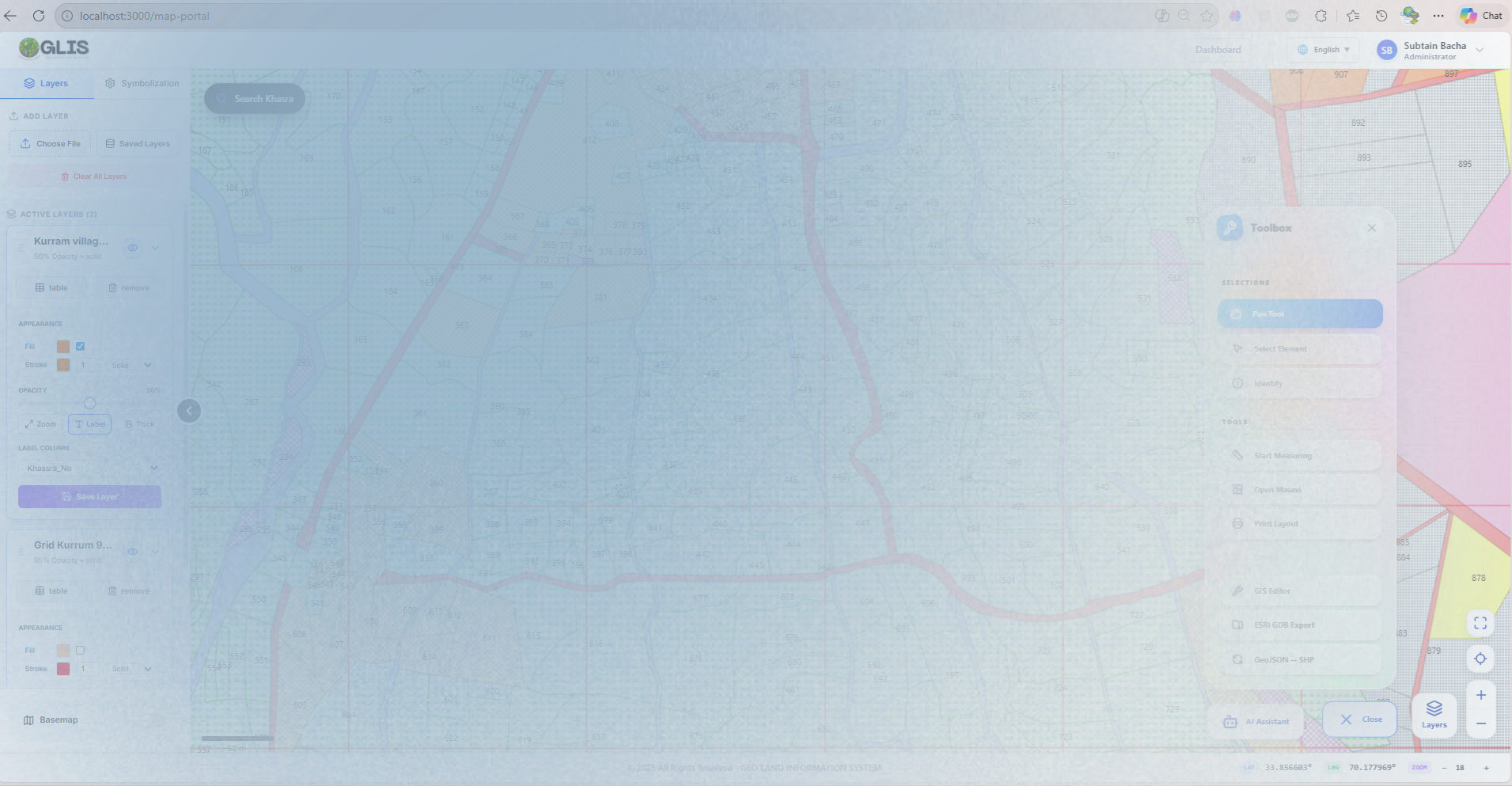
Automatically generate comprehensive index grids for each mouza (revenue estate) with intelligent spatial partitioning and systematic numbering. This feature revolutionizes land record management by creating standardized reference systems for efficient parcel identification and navigation.
• Rapid location of any khasra within large mouzas
• Standardized reference system across districts
• Simplified field survey coordination
• Enhanced spatial query performance
Interactive grid with hover highlighting and selection capabilities
Tehsil_Land_Records.glisws
Last saved: Today, 2:30 PM
Urban_Planning_Project.glisws
Last saved: Yesterday, 4:15 PM
Save and restore your complete GLIS working environment, similar to ArcGIS MXD files. This feature preserves your session, allowing you to resume work exactly where you left off or create multiple workspace configurations for different projects. A robust GLIS system enables sharing of spatial data layers and workspaces among team members within the GLIS platform, facilitating collaboration across departments.
• No need to reconfigure complex map projects daily
• Maintain consistency across team members' work
• Create audit trails of project development
• Reduce setup time from hours to seconds
The GLIS Converter is an integrated geodatabase ingestion and conversion engine capable of reading Esri File Geodatabases (GDB) directly. It supports conversion of GDB feature classes into Shapefile, GeoJSON, and KML formats without the need for external software.
GLIS provides a powerful AI-driven tool to classify web Satellite/Aerial imagery and Sentinel-1 & Sentinel-2 data into meaningful landcover categories such as vegetation, water bodies, built-up areas, and barren land. It supports customizable classification schemes, automated color-coded symbology legends, conversion of image classes to GeoJSON vector polygons, and integration with spatial datasets, enabling efficient analysis, visualization, and decision-making for land management and planning.
GLIS includes advanced 3D geospatial capabilities for urban planning and land administration, and infrastructure management. Our advanced 3D engine transforms traditional 2D data into immersive three-dimensional models that provide unprecedented insights for decision-makers.
3D building models with height attributes
Water flow and drainage network simulation
3D land parcel visualization with ownership data
Terrain analysis for construction planning
Interactive 3D Globe
Verify field survey accuracy by comparing 2D measurements with 3D models, identifying discrepancies in real-time.
Simultaneously visualize underground utilities, surface features, and above-ground structures in single 3D view.
Present complex land projects to non-technical stakeholders through intuitive 3D visualizations that everyone can understand.
Make informed decisions with comprehensive 3D analysis tools for slope stability, flood risk, and development impact assessment.
The AI Assistant also enables natural language, action-based interaction with the system. Users can perform GIS and cadastral operations by simply typing intuitive commands such as "select Khasra number 119" , which instantly locates and highlights the corresponding parcel boundary on the map, or "apply symbology by Khasra type" , which automatically generates and applies color-based symbology according to parcel classification. This AI-driven interaction streamlines workflows, improves usability for non-technical users, and introduces a new level of efficiency and intelligence into land administration processes.
The GLIS platform showcases our expertise in developing enterprise-grade GIS solutions for land administration. Features demonstrated represent our technical capabilities and can be customized to meet specific client requirements. Contact us for a personalized demonstration tailored to your organization's needs.
For a demo, please email:
info@ssbacha.net
Through Contact form request
Our team can adapt the GLIS platform to meet your specific land administration requirements, integrate with existing systems, and provide comprehensive training and support.
Schedule a Consultation