Technology Solutions For Government & Private Sector
SSBACHA TECHNOLOGIES PVT. LTD. delivers comprehensive digital transformation services, specializing in GIS solutions, custom software development, data analytics, and IT consulting to drive operational excellence and data-driven decision-making.
Digital Transformation Partner
Comprehensive technology solutions for government entities and private organizations across Pakistan and beyond


SSBACHA TECHNOLOGIES PRIVATE LIMITED
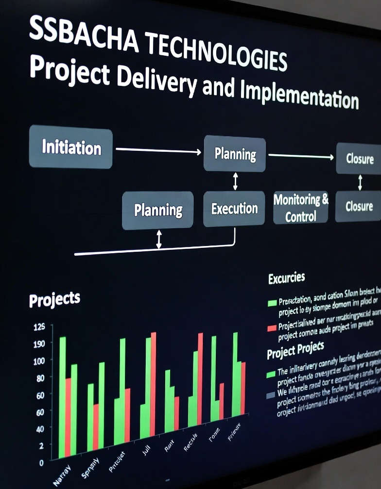
SSBACHA TECHNOLOGIES PVT. LTD. is a premier technology solutions provider registered in 2026, bringing together decades of industry expertise with cutting-edge technological innovation. Our firm specializes in delivering comprehensive digital transformation services to government entities and private sector organizations across Pakistan.
Our firm is led by Managing Director Subtain Hussain Syed, who brings over 19+ years of extensive experience in GIS implementation, software development, data analytics, and digital transformation. His leadership ensures every project benefits from deep industry knowledge and a commitment to technical excellence.
We are committed to client success through technological empowerment. We believe in building long-term partnerships by delivering solutions that not only meet immediate needs but also provide sustainable value and a competitive advantage in an increasingly digital world.
Our mission is to empower organizations with technology solutions that enhance operational efficiency, enable data-driven decision-making, and drive sustainable growth through innovation and excellence.
Comprehensive Technology Services
We deliver end-to-end technology solutions designed to address complex business challenges and drive digital transformation across sectors.
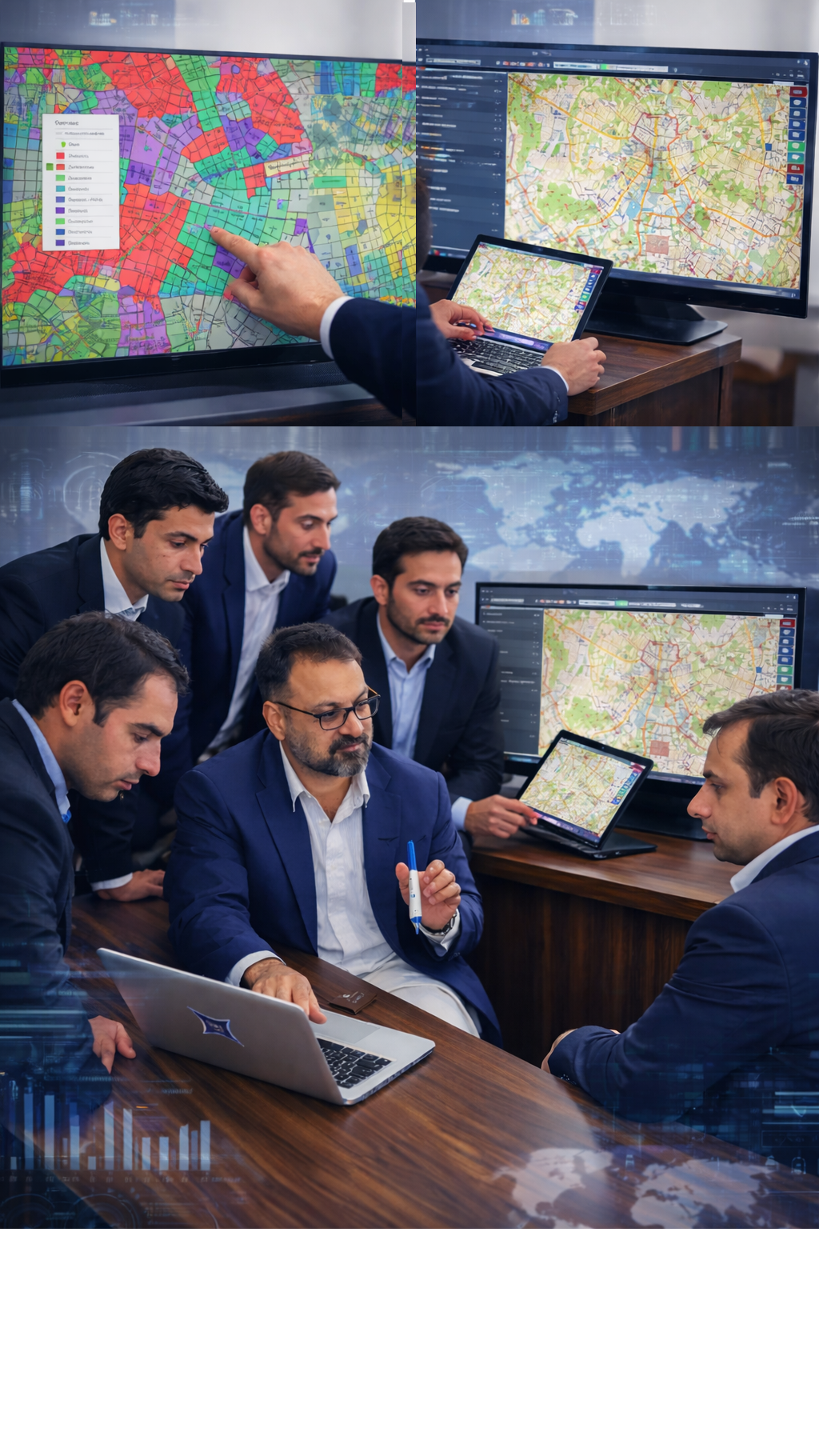
Geospatial Solutions
Enterprise GIS implementation, spatial analysis, cadastral mapping, land records management, and location intelligence services using ArcGIS, QGIS, and proprietary GLIS platform.
Software Development
Full-cycle custom software development including web applications, mobile apps, desktop solutions, system integration, and enterprise software tailored to specific business requirements.
Data Analytics & BI
Business intelligence solutions, Power BI dashboards, advanced analytics, data visualization, and reporting systems that transform raw data into actionable insights for strategic decision-making.
IT Consulting & Strategy
Strategic IT consulting, digital transformation planning, technology roadmap development, system integration, and IT infrastructure optimization services for sustainable growth.
Need a Custom Solution?
Beyond our core services, we offer specialized solutions including:
All solutions are tailored to your specific requirements. Contact us to discuss your project needs.
Proprietary Technology Solutions
Innovative software products and platforms developed by our team to address specific industry challenges.

Geo Land Information System
Enterprise Web-GIS Platform for Land Administration
GLIS - Enterprise GIS Platform
Our flagship Geo Land Information System (GLIS) is a registered software product specifically designed for government departments including Revenue Authorities, Municipal Corporations, and Urban Planning agencies. GLIS represents years of expertise in land administration and cadastral management.
-
Complete Web-based GIS module for land administration and revenue operations
-
Integrated spatial and non-spatial datasets for comprehensive land records management
-
Scalable, secure architecture with role-based access control and audit trails
-
AI-powered assistant for natural language queries and automated workflows
CIDOS - Comprehensive Intelligence & Data Operations System
CIDOS is our enterprise-grade security and intelligence platform designed for government agencies, law enforcement, and organizations requiring advanced data integration, analysis, and security monitoring capabilities. It provides a unified platform for intelligence gathering, threat analysis, and operational coordination.
-
Advanced data integration from multiple sources including IoT devices, databases, and external APIs
-
Real-time threat detection and predictive analytics using machine learning algorithms
-
Secure communication and collaboration tools for multi-agency operations
-
Compliance-ready with data encryption, audit trails, and role-based access controls
CIDOS Enterprise
Comprehensive Intelligence & Data Operations System
Land Records Management Systems
Complete solutions for land record digitization, cadastral mapping, revenue management, and property registration systems integrated with GIS.
Power BI Dashboards & Analytics
Interactive business intelligence dashboards for real-time monitoring, data visualization, KPI tracking, and executive reporting across departments.
Asset Management Systems
Comprehensive asset tracking and management solutions for utilities, infrastructure, facilities, and equipment with GIS integration and predictive maintenance.
19+ Years of Industry Expertise
While SSBACHA TECHNOLOGIES is newly established, our leadership brings decades of proven experience in enterprise technology solutions.
Specialized in large-scale GIS implementations for government and international organizations
Implementing geospatial systems for land administration, urban planning, and infrastructure management
Designing scalable enterprise applications and custom software solutions
Full-stack development expertise across multiple platforms and technologies
Technology Partners & Platforms
We work with industry-leading technologies and platforms to deliver robust, scalable, and future-proof solutions for our clients.
Ready to Transform Your Organization?
Partner with SSBACHA TECHNOLOGIES for enterprise-grade solutions that drive digital transformation, enhance operational efficiency, and deliver sustainable competitive advantage.
Prefer to reach out directly?